Maps

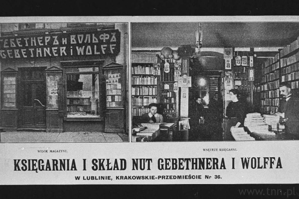
Before becoming home to the first Polish printing house (1930), Lublin was one of the most important book trade centers in Poland (the Polish-Lithuanian Commonwealth?). One of the first bookstores in Lublin was opened by Kazimierz Szczepański around 1806 at 19 Rynek Square. Szczepański's Bookshop operated intermittently until 1852. In the years 1820–1827, the Bookshop of the Lublin Society of Friends of Sciences operated in Krakowskie Przedmieście. In 1828, Samuel Streib's bookshop was established at 136 Krakowskie Przedmieście (now 27 Krakowskie Przedmieście), and it operated until 1856. In 1900, there were 10 bookstores in Lublin, mostly on the main street of the city - Krakowskie Przedmieście. The largest bookstores (trading mainly in books) were: Arcta Bookshop, Słowakiewicz Bookshop, Cederbaum Bookshop, and Kiesewetter Bookshop.
Memory Trail "Lublin. Memory of the Holocaust" is designed by the "Grodzka Gate – NN Theatre" Centre and prepared for the 75th anniversary of the commencement of Operation Reinhardt and the Liquidation of the Podzamcze Getto in Lublin.
The idea for the Memory Trail has its origins in the recognised need to mark the sites connected to the Holocaust of the Lublin Jews in the public space of the city.

This interactive map provides information on the sites directly connected with the events that took place during “Operation Reinhard” each of them is marked with a Google marker. The map is based on pre-war maps of Lublin, unpublished German maps, and aerial photos from World War II. The map also includes detailed information about the Majdanek concentration camp [KL Lublin], which was instrumental during “Operation Reinhard”.
![Map of the Majdanek [KL Lublin] concentration camp](/cache/local/image/600x1024/places/Mapy%20tematyczne/Szczeg%C3%B3%C5%82owy%20plan%20Majdanka/KL_Lublin_600x400.png/)
This map contains a detailed layout of the buildings situated within the boundaries of the camp at the peak of its operation. By clicking on the individual locations, you will see descriptive information about the type, purpose of the building, and “address” that was recorded in the camp registry.
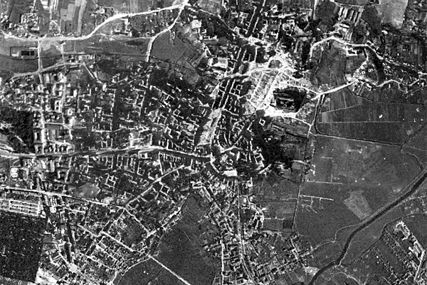
The 1944 orthophoto map of Lublin was compiled from a series of German aerial photos between May 28, 1944 and October 27, 1944, stored in the National Archives and Records Administration (NARA) in the USA (series 373-GXPRINTS).
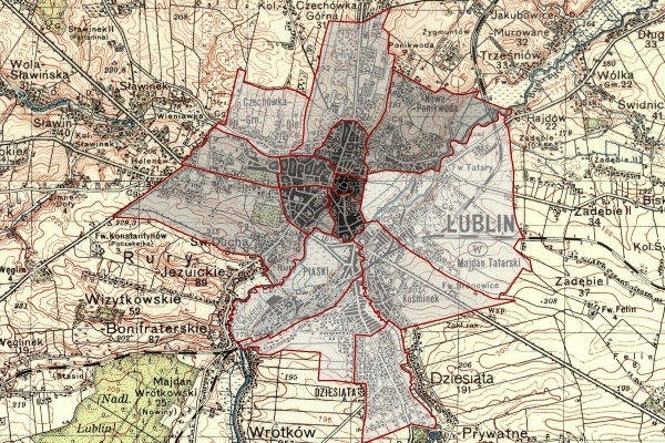
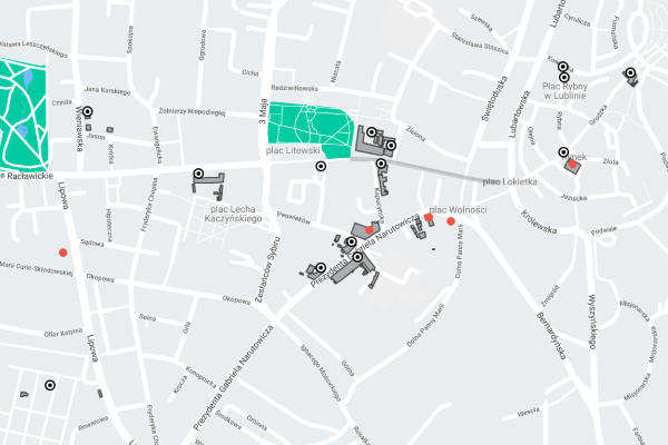
This is a map of Lublin's districts in the interwar period. It presents a proposal for delimiting the city area based on historical, geographical, and functional criteria. Ultimately, the map will contain 14 highlights redirecting users to more detailed maps.
The map shows the borders of the city of Lublin and Wieniawa, Czechowka, Kalinowszczyzna, Sierakowszczyzna, Ponikwoda, Piaski, and Bronowice.
By clicking on a selected area, you will be redirected to a detailed map displaying places related to databases of people, events, and sources documenting the history of residents' lives.

This map of Lublin is a digital compilation of 3 map sheets by S.J.N. Łęcki: the 1783 detailed city plan from the Lublin State Archives collection (APL, PmL, ref. no. 3), the 1780 general municipal land map from the Central Archives of Historical Records collection (AGAD, Cartographic Collection, ref. no. 92-13), and the 1789 Jurydyka of Wieniawa map from the Lublin State Archives collection (PmL, ref. no. 73). The compilation is supplemented by a 1797 detailed map of the Lublin castle (AGAD, Cartographic Collection, ref. no. 4-31).

The Grodzka Gate–NN Theatre Centre in Lublin manages 4 places where the history of Lublin is told.

This map shows the various addresses of Lublin Jews living in Antwerp from the end of the 19th and first half of the 20th centuries. These addresses-places are part of the larger project named Lublin-Antwerp in which we try to follow and learn more about the individuals and families from Lublin during their stay in Antwerp.
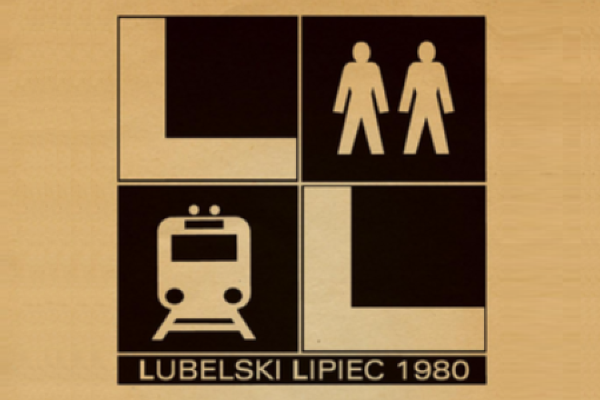
In the 1970s the growing economic crisis, caused by the inept policy of the Polish People's Republic, led to an economic stagnation. The shortage of raw materials needed for industrial production, the lack of skilled workers, and constant electricity outages and gas supply interruptions influenced the quantity and quality of goods and services available on the market. The economic stalemate has contributed to the rising prices and decreasing wages, which has exacerbated public discontent. In light of the inefficient operation of the system, in 1980 a wave of strikes began across the Lublin region. In a dozen or so days as many as 91 workplaces were involved, and it all "started with the cutlet".
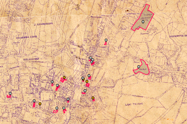
This map shows the most important places connected with the life of the Lublin Jewish community after the city was "liberated" by the Red Army, as well as during the Stalinist times.

This reconstruction of a Lublin Union period map of Lublin was made possible within an interdisciplinary project based on the expertise of Lublin researchers. Based on research documentation and scientific studies, the experts have taken on creating a graphic representation of the buildings, water network, and the layout of roads and plots of land within the city.
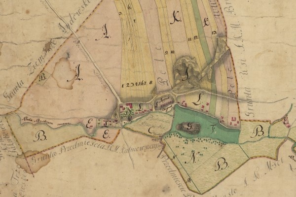
Mappa Geometryczna Wsi J.K.M. Tatarów (...) 1784 roku sporządzona.
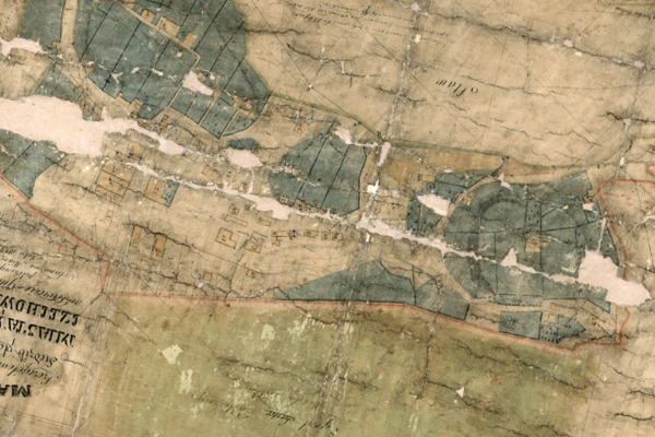
This is a detailed map of the settlements, squares, and gardens in the Wieniawa and Czechówka Dolna neighborhoods, located in the Lublin district and governorate. This map was developed between 1846-1847 (APL, AmL, reference number 72) and it is an interesting example of a 19th-century cadastral map.

This map of the Piaski Suburbs was based on the City of Lublin map by W. Ziółkowski from 1827 from the Lublin State Archives collection (APL, PmL, reference number 317).

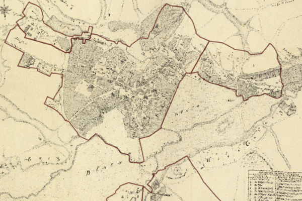
Map of Lublin by S.J.N. Łęcki from 1783, copied by F. Bieczyński in 1852.
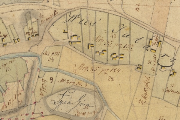
Plans of the rural areas of Tatary and Dziesiąta in 1821-1824
Places in Lublin

Places in Antwerp

Maps

Database

The database of the Grodzka Gate–NN Theatre Centre is a module-based collection of records related to Lublin and the Lublin region’s past.
It was created in order to organize, interrelate and present archival and historical information from various sources in an accessible way.
News


Contact
The Grodzka Gate–NN Theatre Centre
ul. Grodzka 21, 20–112 Lublin
tel. 81 532 58 67
e-mail: [email protected]
Donations
